Peculiarities of the National GPS-navigation. Polar Urals

26.03.01

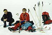
So our trip begins!
Peculiarities of the National GPS-navigation. Polar Urals
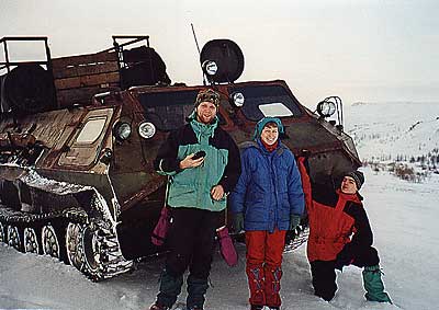
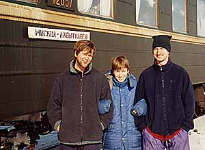
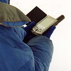
Exit from the car of a train with the romantic name "Moscow Labytnangy" and immediately understand that "here you are not here! Although, like, and the weather is nice, but pulling a breeze blows through. But the cold can not stop our leader - this fighter for the promotion of technical progress in the Far North. He immediately tries to bind the card into the Palm Vx to the coordinates of our real position. Standing in the cold, patiently waiting for the completion of the historic moment. We, too, for the progress! In general, ... Associated all-terrain vehicle, an unknown, but rather "prohodimistoy" design, gives us, as follows, to warm up walking and dovozit almost to the entrance to our valley - a point of departure. Vzmetnuv to the sky clouds of snow treads, he is hiding, but we are going to ski a bit further and get up on the first night.
Peculiarities of the National GPS-navigation. Polar Urals
About -20 and the wind. All are engaged in furnishing life, but our leader is only interested in the process of "binding of the second coordinate" in the Palm Vx, Cassiopeia E125 inspection work and GPS eTrex. It turns out it works! "Unexpected" is called. And even what we see on the paper map, and around, completely coincides with the instrument readings! Fall asleep, it is nice affected power of knowledge.

Conclusions of Day:

GPS for Palm Vx shows that he had found as many as 12 satellites for a long time to move to the small screen some numbers. Waiting for results is delayed, and in fact does not end. So it is not clear - the receiver has identified its location or not. To make sure that the satellite signals received clear and you can work on, you need to go to another application (NMEA Monitor), but it's not very convenient. Another subject - eTrex in conjunction with the Cassiopeia "savvy" is much faster: catch the satellite signals and then displays the accuracy of the coordinates.
Peculiarities of the National GPS-navigation. Polar Urals
True, Cassiopeia E-125 so far focused on the ground worse than us: the difference in determining the point on the map is about 800 meters. While the maximum precision of our measurements - 6m. This is probably due to the fact that the map for Cassiopeia had to cook on a desktop computer. The coordinates of the night:

N 66 59 21.5

E 65 28 40.4

27.03.01

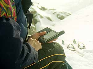
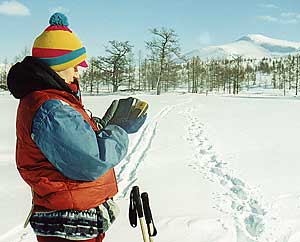
Skiing - some forgotten since last year feeling - so captures us that the leader remembers his mission support progress "just after lunch. We decide to make a groove out on the Grand Pass, unless the weather allows us. Just the weather causes some doubts. On the one hand, it seems to be sunny and clear but cold and wind reduce those charms to naught. Besides from some creeps a cloud. Head gets the treasured box with the devices and navigation equipment shifts from it into the large pocket of his wind jacket. He wants to test the Cassiopeia E125 and GPS eTrex and Palm Vx in motion, but ... nothing good comes of it.
Polar Urals "width =" 400 "height =" 254 "/>
Technique - it's not you people! It can not operate in such an inhumanly cold conditions! Only one transition in the freezing cold in the forty minutes - and eTrex freezes completely, and Palm Vx first few times clears already downloaded map, as if we were already out of it, and then completely dark screen and dies. However, we know that they could not get out of Raina Rai-Out, without noticing it, and shifts all the Yura frozen "glands" in the inside pocket - warming up.
Peculiarities of the National GPS-navigation. Polar Urals
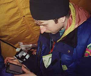
In the evening, in the relatively warm tent, and upon closer inspection, it turns out that it was not only cold but also user error! Just the first coordinate is defined for the gathering of the train, was installed is not entirely true, and it confused the poor Palm Vx.

Conclusions of the day:

ETrex GPS-receiver can withstand the cold of about forty minutes. Otherwise, to invent, as it is thawed. The reason of the periodic dumping of cards on Palm Vx - correctly identified the first time the coordinates of the binding. Apparently when they installed the GPS-receiver was not yet on the operating mode. Anchor Points Cards can be edited manually, which we did.

28.03.01

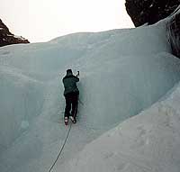
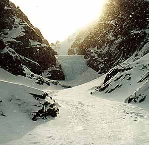
All the morning set to pass a beautiful pass Vodopadny, which begins at 50 meters from our tent, and consists of three stages of the azure pure ice! The truth is found in places still water, apparently overheated sun. The weather is good: cold, wind and sun. We have already realized that here, when you talk about the weather, of wind and you can not mention. It means always the case. Since the weather is just great!
Peculiarities of the National GPS-navigation. Polar Urals
Put on the cat and ... Do not remove them until late afternoon. At dinner the head with one hand, setting the burners, erecting another wall of snow from the wind, the third gets the hardware. To the delight of his Palm Vx, which now total order of all defining coordinates, is absolutely right shows where we are! After lunch, he praises his technique: you can look at the compass on the move, we can define the anomaly deviation from the prime meridian, you can see at what height we are now, etc. A little later the head, as befits a real leader, sends one of us to pave the way forward, and he tries to figure out with Palm Vx average speed of our movement. Everything works fine, and our speed too low - 3 km / h! By evening, the weather begins to deteriorate and sunny day, gradually turns into a foggy evening.
Peculiarities of the National GPS-navigation. Polar Urals
Horrible visibility! .. Cassiopeia but rather specifies the map location of our lodging, Jura puts on a map point waypoint and in any case writes the coordinates in a notebook.

Conclusions of the day:

In just two days hiking already shown the first laws in the work of our navigation equipment: a Cassiopeia E-125 on cold weather becomes a little darker screen, but this is adjusted by simply increasing the brightness. Palm Vx screen freezes in the cold, it becomes darker and starts to "slow down", is slowly re-drawing the image. But in the Palm Vx is a very useful application that allows you to use a GPS-receiver as a compass and determine the deviation of the magnetic meridian.I must say, very useful quality in the Polar Urals, where the deviation is no more - nor less than 22 degrees!
Peculiarities of the National GPS-navigation. Polar Urals
GPS eTrex, thanks to the excellent reception of satellite signals, can be operated from a pocket of wind jacket that helps to solve the problem with freezing and allows you to navigate directly to the motion. The long cable that connects it with the Cassiopeia E-125, makes it possible to work continuously and the cold. GPS is put in a warm pocket and a pocket computer can be removed, since in this case the battery is heated at the hands of even a mitt. At this time the results of our orientation coincided with the results of Cassiopeia, which suggests errors in the map. It is a pity that in OziExplorer CE is not possible nor create or edit waypoints card. All must be prepared in advance on the desktop. Conversely, if Palm is very pleased that such opportunities are there - it makes the card more flexible. Map of Palm requires two anchor points, which you can edit them. In the evening, change batteries in Cassiopeia. Old can still work, but do not want to take risks. Last night was clearly over 30 Celsius. The coordinates of the night:

N 66 56 28.5

E 65 26 38.0

Height night: 687 meters above sea level.

29.03.01

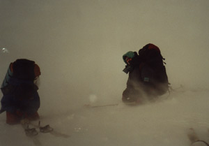
Who would have thought, how will that day and how it ends! Gray windy, but fairly warm morning. According to the plan we have planned to undergo the pass called Unexpected. In fact, we just need to go through a narrow part of the plateau. But this was not so easy. Initially was poor visibility - 150 meters, then the visibility had deteriorated to 50 meters. When we realized that the pass is somewhere nearby, has almost nothing to make out it was impossible. Put the cat and began to climb. And when the came out on top of the plateau, we realized that would be better if we were not doing this. Upstairs raging snowstorm. We searched for quite a long time more or less suitable descent, constantly bumping into the cliffs and rock dumps. According to the map relative to the normal descent was only one a special place.
Peculiarities of the National GPS-navigation. Polar Urals
Live like very much and our leader, holding the stones, pulled Cassiopeia. Small and heavy, she in a similar situation was certainly more convenient than paper torn by wind map. We almost never seen in the blizzard that it specifically does, and after a while, guided by his shouting and vigorous waving of hands, moved somewhere much left. As it turned out later, Cassiopeia not let them down and showed us not only to the point of descent, but also the altitude at which we were at that time. The descent was long, the wind and snow mercilessly hammered and blew us by not allowing even his face turned away. Two participants literally safely from the slope: Go down about two hundred meters, they were able to stop. Thus, it was discovered that the rock below, no discharge, and was soon joined by others. In a situation similar to the Solaris environment, we are somewhere down. State of the team was dismal, and our wise leader to us all comfort, said: "We put more tents, and then turn on the GPS and see where we are!"
Peculiarities of the National GPS-navigation. Polar Urals
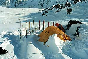
We just calmed down, and cheered, holding tight to each other, not to fly, quickly set a tent and built a snow stenochku around her. Get into the walls of the house was existent nylon pleasure! Can be very useful and proved to be a chocolate bar.Feeling the extraordinary surge of strength, decided nevertheless to find out where we actually are. When the head of everything connected and turned on, we saw on the small screen Cassiopeia your location. I must say that it was damn nice in this difficult moment to see the map on the big red arrow c says "you are here." Well, just the tears in his eyes welled up! Glory to technical progress! With this in mind we spent the night, and because of the severe snowstorm every two hours one of us chooses the outside and about an hour trying to clean the tent from its floods of snow.

Conclusions of the day:

The events of that day suggest that the main use of GPS in travel may be precisely the orientation in bad weather when a compass or a map to use either hard or impossible. Perhaps that take a similar set of navigational equipment worth even if it is useful only once. With proper configuration, and the skillful use of all of these "technical bells and whistles" in a campaign can greatly help out and possibly save a life. The coordinates of the night:

N 66 55 25.3

E 65 20 48.0

30.03.01

After overnight fighting with the elements awake late. The blizzard is over, and after a visual inspection of our locations we conclude: Cassiopeia with our views on this are absolutely identical.
Peculiarities of the National GPS-navigation. Polar Urals
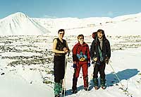
Without breakfast, for fear of starting a new blizzard (since the wind was blowing very strongly), we will quickly go down. Now is the time to check the Cassiopeia and the GPS in motion. Everything works great. Arriving, finally, to the place where the wind does not blow away with the foot firmly decide to dine. Our head in the process of cooking is not involved, but asks everyone who walks past him, take his picture with the beloved "Casey" on a background of mountains.
Peculiarities of the National GPS-navigation. Polar Urals
In the evening, the night came thoughts about how cool it would take a GPS-sets in the summer: they will not freeze, and they can be used at full capacity.

31-2.03.01

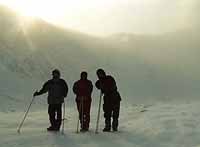
The next three days can be arbitrarily combined, since nothing significant happened. Our route lay to the highest point Paypudynskogo array is just a few hours away by train. Per minute unloaded at the correct station, we just ran for four hours in the frost, and with a strong crosswind to almost imperceptible line (a few trees and bushes) in front of "our" top and put the tent.
Peculiarities of the National GPS-navigation. Polar Urals
Out in the morning the tent was nearly impossible - again began snowstorm. The day passed in a dreary waiting and exploring new and new capabilities of our navigation devices. The coordinates of the night:

N 67 06 50.7

E 65 18 52.3

Height night: 185 meters above sea level on the testimony of Cassiopeia.

205 meters above sea level on the testimony Palm Vx.

3.04.01

Nobody could imagine that in the morning the weather can be so gorgeous! The sky is cloudless, and, most striking, there is no wind. At quite a decent frost in the shade, we climbed the sunny side of the mountain t-shirts! On this day dream of all travelers, especially those that are technological advances in the Far North! We climbed to the top Paypudyn Chorro and saw all the mountains around the Polar Urals. But even this magnificent sight could not distract from the campaign manager of his mission. We somehow came to the summit of beauty, but it - check the instrument readings. Technology, for the umpteenth time, did not disappoint. All figures displayed on small screens, are consistent with visual observations and our simple two-kilometer map. That was the end of our adventures in the Polar Urals with Palm Vx, GPS eTrex and Cassiopeia E-125. Now we know that the best tan is acquired under the Vorkuta, the strongest winds constantly blow at Vorkuta, most unforested mountains are also located under the Vorkuta and navigate in these mountains is best done with satellites and modern technology!
Peculiarities of the National GPS-navigation. Polar Urals
Vertex Paypudyn Chorro

N 67 09 34.8

E 65 17 21.2

Height top:

1082 meters above sea level on the testimony of Cassiopeia.

1091metrov above sea level on the testimony Palm Vx. The rise took about 4.5 hours.

On the descent the following results:

Our top speed on the descent 27,5 km / h

Average speed of our movement 3.2 km / h

The path to the top of 5.82 km

Time 1.56 hours is significant that the newly defined after the return of the coordinates of our nights practically coincided with certain earlier. Discrepancy only in fractions of seconds!

N 67 06 50.9 5 meter accuracy

E 65 18 52.8

Polar coordinates of the village:

N 67 03 28.9

E 65 20 58.7

Findings on GPS-kit:

Pocket PC part (Cassiopeia + OziExplorer CE):
  1. Scalable map.
  2. Ability to work with a color card (when driving on rough terrain in the summer of informative maps of increases in the number of times).
  3. Information line, which shows the main parameters (coordinates and elevation). No need to go into other applications or dig with a GPS-receiver.
  4. Ability to work with the Cassiopeia-volatile memory modules.
    • no limit on the amount of cards
    • card will not be lost when hard reset
    • You can store the software distribution and backup
    • You can store information (coordinates of the points and so forth) in non-volatile memory
  5. Ability to quickly change the batteries on your PDA.
  6. The absence of binding function maps to the terrain and the correction of this binding.
Palm OS part (Palm Vx + Atlas)
  1. Binding card directly on the ground, correcting the binding maps manually.
  2. Charge the battery Palm can only with the help of special devices, simple replacement is not possible.
  3. Program sizes are small, the speed of their work is sufficient.
  4. The presence of the spectrum of specialized programs (Atlas, Tracker, Compass, NMEA Monitor)
PDA and GPS connection via cable
  1. Long connector between the PDA and GPS allows the use of the complex so that the work is taken out of his pocket only PDA (eg, rain).
  2. Device independent of each other and can be operated separately (if the most GPS provides such features and functions).
  3. Replacement of the CPC to the new model does not require replacement of the GPS-receiver, enough to buy a new connector cord.
Set-based Pocket PC can be recommended for professionals and enthusiasts who are familiar with geodesy, able to independently create the necessary map using the desktop version of OziExplorer. In addition, all those who do not want to deal in any orientation, either in geodesy, but use the Pocket PC set in this case, only if you have been trained to work cards. Set on Palm can be recommended for people with some experience in orienteering, the ability to accurately determine their location for a map to the area. Regardless of the platform in the difficult field conditions can be recommended to use the GPS-receiver, abutting the PDA via a cable. This solution is more flexible and allows you to work with each device separately. In the case of critical dimensions and weight of the kit can be recommended to Palm OS kit with a special GPS-receiver, such as Rand McNally.
Polar Urals "title =" Peculiarities of the National GPS-navigation. Polar Urals "width =" 400 "height =" 207 "/>
Preparation of the project was carried out by the Information Internet project "hPCru: handheld computers in Russia"

CPC provided by MakTsentr

GPS-receivers provided by CB-Grad.

Invaluable assistance in the preparation of the expedition had Pavel Bulgakov Sergey Aleshin.

Discussion of the article in the conference authors, translation:

Anton Kuznetsov

Svetlana Kostygova

Yuri Kostygov