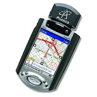
Practical aspects of connection and use of domestic GPS-navigators in conjunction with Palm computers

Briefly about the GPS system

GPS (Global Postioning System, code name - NAVSTAR) - satellite system, developed and maintained by the Ministry of Defense. Provides the ability to accurately determine its location on the earth's surface subscribers with GPS-receivers. When designing a system primarily meant, of course, its military uses, but domestic component of the application of GPS-navigation has become so popular that in May 2000. decision of the U.S. president had been cleared of all obstacles (called Selective Availability - selective access) that first deliberately introduced into evidence for the underestimation of the accuracy of satellite positioning household (not military) devices. Before this event, the accuracy of the receiver did not exceed + /-100m 95% of work time and only the remaining 5% of the time, the receiver is working at full capacity. " To the receiver can determine the coordinates, he obviously should be able to "see" the sky - that is, inside the system will not work. Modern receivers, as a rule, all 12-channel (ie, allow you to track up to 12 satellites simultaneously) and others have similar characteristics, differing mainly by the presence or absence of built-in mapping capabilities. The process of determining the coordinates of the receiver looks like this:
  • when you turn on the receiver after a sufficiently long interval (so-called "cold start"), the receiver begins to receive signals from satellites and determine exactly which satellites from all groups are available from this location. Group of satellites that are visible at a given point called the "Almanac." After turning off the receiver, while keeping in mind the latest almanac in the case of reclosing after a short break, while fixing the receiver increases significantly (hot start).
  • Receiver, receiving from satellites exact time (which last well synchronized with each other), the delays calculates the physical distance from them (the speed of propagation of radio waves is known). Having appeared in three or more satellites, the receiver, the method of triangulation is obviously an opportunity to determine their exact position in 2D-space. Having appeared in four or more satellites, the receiver can also determine the height and the subscriber above sea level, which, however, is calculated with a known higher accuracy than the coordinates on the earth's surface.
Obviously, the more satellites the receiver is able to interrogate and more spaced out, these satellites on the celestial hemisphere, the more accurate will be his testimony. At this time (after the abolition of the United States of SA), positioning accuracy ANY GPS-receivers under normal conditions is not more than 5-15 feet.

How to connect the GPS-receiver to the Palm (and what receivers can be connected)

Unfortunately, as a rule, mapping capabilities that can provide advanced GPS-receiver, are insufficient for a meaningful and easy to use all the opportunities that can provide the user system GPS. Especially frustrating situation with Russian maps, which are presented in receivers particularly poor. The possibility of the same load your own maps in most receivers are also missing due to the closure card formats almost all manufacturers of GPS-navigators, and for regular updates of existing maps can only dream about. Exit the author seems to be connected to the receiver of the independent predictive device, which will be able to perform these and many other useful features. It is obvious that under this article, such a device made by the CPC brand Palm. In order to implement a bunch of PalmGPS, you must first verify that your receiver has a serial port for connection to the computer (as a rule, many modern receivers have it) that the receiver is able to give the data using the protocol NMEA-0182, -0183 or EarthMate (proprietary protocol for their company DeLorme receivers of the same name EarthMate). To implement a physical connection is needed, obviously, a connector for the GPS-receiver, a connector for Palm'a and that's all it is necessary to build, given the characteristics of the contact wiring specific receiver and Palma.Way easier - as a rule, you can always get a cord to connect the receiver to the serial port (from the manufacturer or, if the receiver is the production of such well-known companies like Garmin, Magellan and some other third-party cables). Also, as a rule, is not difficult to get a cable for connection to a PC and Palm. When connecting these cables, you should not forget about the null-modem essence of both of the above cables as well as the fact that the final connection is Palm-GPS should also get a null modem (due to the fact that both Palm and GPS - the essence of DTE-device). Thus, besides these two cables, we also need a null modem adapter / cable, which we "deploy" one of them.

A detailed overview of the software (Atlas and Tracker from GPS-Pilot, HandMap of Evolutionary Software, TZ-GPS, NMEA Monitor) with the peculiarities of each

To work with GPS-receivers, the software that exists at the moment Platform Palm, can be divided into three categories:
  • Software for raster maps
  • Software to work with vector maps
  • Utility software
Let's discuss each of the categories.

Software for raster maps

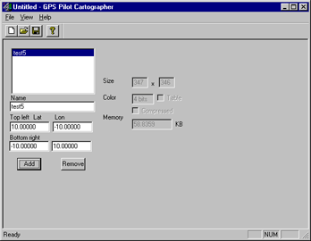
The choice is small - products company GPS-Pilot - Atlas, Tracker, Fly. In all three programs, maps downloaded program Cartographer (Fig. 1), which can be defined as a desired color derived maps and coordinates of the corner points of a convertible piece of card to bind her even when converting. If this is not done with the conversion, then after binding can be achieved even at Palm'e (two-point and direction to the north).
Practical aspects of connection and use of domestic GPS-navigators in conjunction with Palm computers
GPS-Pilot Cartographer
Practical aspects of connection and use of domestic GPS-navigators in conjunction with Palm computers
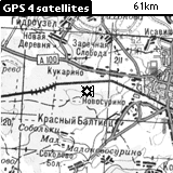
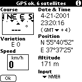
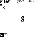
GPS-Atlas is designed for easy orientation on the map. As mentioned earlier, the raster map is converted to a format Atlasovsky program Cartographer. Location marked arrow on the screen, and the map with respect to the center moves. If you scan the same card in several scales, and to bind each of them, by pressing the scroll up / down Atlas will switch between the scales. This feature becomes extremely useful in the manufacture of, for example, a larger map of settlements, combined with small-scale road map of the area. Over the actual working screen, placed a service cap, showing the amount of "catch" the satellite, speed, scale maps, etc. The picture on the right shows another possible operation screen of this program, which displays in detail the speed, position, direction, altitude, etc. Immediately select the protocol that will communicate with the receiver and Atlas.
Practical aspects of connection and use of domestic GPS-navigators in conjunction with Palm computers
The main working window
Practical aspects of connection and use of domestic GPS-navigators in conjunction with Palm computers
Alternative operating window
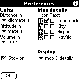
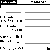
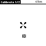
Below shows the settings Atlas'a (where, in particular, can put daw that Palm itself will not turn off when running Atlas), the screen defining a new "point"-a landmark, which can give the name and determine its coordinates (or get them from the receiver). These points will be displayed on the map and they are also necessary in case of linking maps on the fly - see Figure 7, which depicts the calibration process (tying cards) by two points.
Practical aspects of connection and use of domestic GPS-navigators in conjunction with Palm computers
Preferences window
Practical aspects of connection and use of domestic GPS-navigators in conjunction with Palm computers
Calibration
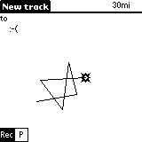
GPS-Tracker Atlas'a differs from the first routing engine. Uploaded on Palm cards will be available in both applications at once. Settings screen calibration, identification of new points in both programs are also identical. The only difference - a permanent record of passable route, which then can be comfortably held in the opposite direction:).
Practical aspects of connection and use of domestic GPS-navigators in conjunction with Palm computers
Route:)
Practical aspects of connection and use of domestic GPS-navigators in conjunction with Palm computers
Record in the process of motion
Practical aspects of connection and use of domestic GPS-navigators in conjunction with Palm computers
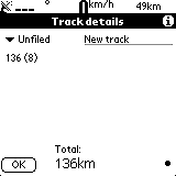
Information about the route traveled by
GPS-Fly - product specific and intended primarily for pilots of aircraft and other aircraft. As part of this article will not be considered.

Software to work with vector maps

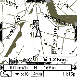
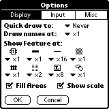
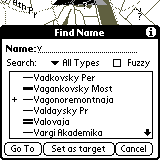
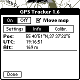
At first glance, this choice a little more, but on closer examination it becomes clear that here we have to stop by just one product - a program HandMap of Evolutionary Software. The reason - the closed card formats in other programs and policies, in which maps are produced and sold solely by the developer. HandMap in this regard has a bit wiser - sold only shell, and the cards can do for yourself. In connection with what is already there at least two cards for Russian cities - Moscow and St. Petersburg. Fig. below shows a map of Moscow. The arrow shows the current location and direction of motion appears in the presence of module installed GPS-Tracker (which comes bundled Professinal version of this product). In the information box at the bottom of the screen displays speed, direction and altitude above sea level. Figure 12 shows the settings window. Figure 13 shows how you can find a particular street (or other) on the map. Unfortunately, the card format does not use international character sets, so that all object names typed in Latin.
Practical aspects of connection and use of domestic GPS-navigators in conjunction with Palm computers
Map of Moscow
Practical aspects of connection and use of domestic GPS-navigators in conjunction with Palm computers
Settings window HandMap
Practical aspects of connection and use of domestic GPS-navigators in conjunction with Palm computers
Search for streets
Practical aspects of connection and use of domestic GPS-navigators in conjunction with Palm computers
Information from the receiver

Utility software

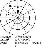
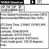
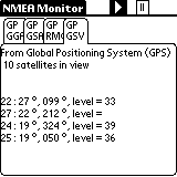
Personally, I opted for two frivarnyh utility, which I quite actively used for navigation. The first utility is called TZ-GPS and the only of its function - the image of "heaven" with the fixed points of satellites, as well as information obtained from satellites - that is, the exact time of the calculated receiver coordinates, speed in knots:), etc. Handy when you start working with the system in order to understand exactly how many satellites to "catch" and when completed the process of fixing the receiver coordinates. The second tool - NMEA-Monitor is designed for display in real time throughout the performance information obtained from satellites in the on-line. Convenient to determine the reasons for too long, the process of finding satellites, etc.
Practical aspects of connection and use of domestic GPS-navigators in conjunction with Palm computers
Program TZ-GPS
Practical aspects of connection and use of domestic GPS-navigators in conjunction with Palm computers
NMEA-Monitor: coordinates, etc
Practical aspects of connection and use of domestic GPS-navigators in conjunction with Palm computers
NMEA-Monitor: Almanac

Advantages and disadvantages of using this binder

Advantages: long battery life Palm'a and availability of sufficient quality thoughtful and worked a variety of software for GPS-navigation for this platform, makes this a bunch of almost perfect integrated solution. The absence of color seems an inconvenience at first glance, but due to this we are strongly committed to winning in the long battery life, small-scale maps obtained (a vector map of Moscow - only 200Kb), etc. Disadvantages: all the same absence of color, or rather a side effect of the lack of color screen: its liquid-crystalline structure makes it virtually impossible to continued work with the device in extreme cold - the screen freezes. Another problem is the same plan - an unpleasant job Li-Ion Battery (Palm V, Vx, Sony Clie, etc.) That's all the same cold. But, in principle, the constant use of GPS-navigation on the march and did not want to - so the device can be kept close to the body warm, and just get to see your current location or to note the next point on the route. Using the same ligament in the car or just warm, is the author of more than convenient.

Law

Technically, under current laws, using GPS-receivers in the territory of the Russian Federation, you have no right. For accuracy of determining the coordinates of the receiver should not exceed 100m. It is clear that these receivers do not exist, especially after May 2000. Those permits that are issued by firms such as Boston PiSi formally valid, can not be and if there are you seriously the claims of bodies, not save. To avoid foul language on this in the description of our legislation and integrity of the firm and I will stop. One good news - there are rumors, it's all in the near future showing more than would be canceled. And we will finally be able to use our devices freely. The authors, translation:

Commercial GPS - devices and commercial software for Psion

With an assortment of commercial GPS - devices are available on the website of "accepted" that "nests" in the walls of the Moscow Aviation Institute. By its tenth anniversary, "Princeton" has released a gift set of two multimedia CD-ROM, on GPS in general and of themselves, loved ones, in particular. If desired, with their contents can be found.

GPS: a walk in the third millennium

Recently had a chance to touch the technologies of tomorrow ... This, I thought that tomorrow, because I was blissfully unaware of how these technologies become commonplace for us today. So that would be correct to say - had a chance to touch the technology of today, which left a fantastic impression of tomorrow. It was during a leisurely Sunday stroll. We walked together with a buddy - with decent earning family lord, from head to toe "packed" naisovremenneyshey portable equipment (and, frankly, a bit on it, on this technique, nuts). Our route lay through the city streets and a little more flattering - if allowed to be called a small forested Moscow park in the immediate vicinity of the benefits of civilization (no need to go anywhere, put on his shoes - and you're outdoors). The purpose of walks - hit me in the heart of the satellite navigation receiver GPS, which a friend just purchased an e-commerce. And along the way to understand - what this nonsense can be helpful (you can see, for example, using GPS to find their way from pub to our house). The program has been implemented only partially. I was genuinely impressed, but the practical use of the GPS receiver could not be found. To travel (a satellite navigation system can be useful only moves in space man), must travel ...
GPS: a walk in the third millennium
ETrex GPS Receiver
GPS Receiver eTrex (without supplementing the title words) - the most affordable in the Russian market model manufactured by Garmin. This kid is worth something around a hundred dollars, but with a strong desire can be found cheaper (a friend gave him 115 conventional units in the course Russian rubles). Applied surprisingly easy to use, simple and reliable. Any more or less people traveling - on foot, by bike or by car - will not lose anything (except, of course, money) to purchase such things. But the fun will receive a "full pockets." Only one upset - eTrex does not work with loaded into its memory topographic maps (although it can communicate with the PC). And the supply of "card" service model, which differ in the addition of a word in the title (the "cool" - eTrex Vista), are significantly more expensive ... The owner of a handheld computer with a eTrex immediately arises the idea - it would be good instead of monochrome, the small screen is the receiver to use color and relatively large screen PDA. Detailed map of the terrain, the possibility of plotting, calculation of distance traveled and remaining, the definition of velocity, altitude above sea level - and all this together with the usual for any PDA functionality. Not the device - a dream ... Although he eTrex, without a pocket typewriter, an unusually good - and in terms of value, and their protection from external influences. Say, eTrex possible without special effects to drop into the water. PDA in such cases comes the inevitable skiff.

Sputnik, the satellite, I - Earth!

System GPS (Global Positioning System - Global Positioning System) was invented in the U.S. in the early 80-ies. During a military operation "Desert Storm" GPS has been tested in action - for the targeting of U.S. missiles. And in those same years, began the active promotion of satellite systems in civilian life. GPS first became widespread in America, then moved around the world. To date, existing navigation systems, only two - the American Navstar and our GLONASS. Although the Russian system is used by military and civilian applications is closed. The operating principle of GPS is as follows. The far-Earth orbit (about 20,000 kilometers) removed 24 space satellites covering their signals all the Earth's surface (except the poles). Terrestrial part of the complex are special powerful transmitters whose signals are detected by receivers satellite and relayed to the surface of the planet. In addition to transponders installed on satellites accurate atomic clocks.To determine the coordinates of a laptop (or placed on board an aircraft, ship, vehicle), the receiver is enough to catch radio signals from three orbiting satellites at a time (the minimum number of channels is usually more). Calculating the time delays specially coded satellite signals (the time of the radiation signal is compared with the internal reference clock receiver), GPS receiver can determine its own geographic coordinates to an accuracy of 10-100 meters. The military receiver positioning accuracy is significantly higher, but these technologies are closed to public use. The Doppler frequency shift of the carrier wave receiver is able to determine the direction and speed of their movement (in a pocket or hand of the owner).
GPS: a walk in the third millennium
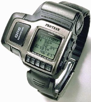
Watches Casio ProTrek GPS
GPS receivers are manufactured by some 150 companies worldwide. The most popular (at least, we have) - Equipment American company Garmin. In addition to widespread eTrex, in Russian shops can be found quite unusual device - like a GPS receiver built in the electronic wrist watch (model Casio ProTrek GPS). For the owner of a Pocket PC or laptop particular interest in the form of GPS receivers connected to the USB port or insert a CompactFlash slot modules. True, the receiver connected to a laptop, can only be used as a stationary device, installed in the wheelhouse of the boat or in the spacious cab of the truck. A card CF, connected to a PDA, you can use exactly the same as the portable receiver GPS - on the go, in a way, in the same car cabin, the ship cabin and, in general, wherever and however you want.

GPS for Pocket PC

Skimmed briefly on the technology of satellite navigation, we call attention to the practical side of things. Modules GPS, if you believe the prospectuses of companies that produce handheld computers and peripherals for them are available for all common platforms. In this screen Palm `and that the color that is monochrome, from full-screen handheld GPS receiver does not differ greatly. And the area of ​​the screen is small and the graphics so-so. (Incidentally, I'm an expert on this part, frankly, a little - perhaps screen Palm `namely, what is needed, and is a picture of heavenly beauty, are reminiscent of Ilya Glazunov's" Peter smacks his son, Zurab Tsereteli). But the class computers Pocket PC for use as a satellite receiver is almost perfect. The cards have a high degree of detail, and color presentation of information makes the orienteering terrain in this colorful show ... Wonderful (though inexcusable expensive) machines - these Pocket PC ... A proposal has a little bit. In the price of computer companies you can hardly find an abundance of models connected receivers. Yet this technique to the amateur and the majority owners of the CCP, it unnecessarily. The cost of that is, ranges from 150 to 300 dollars. You can find and more expensive - if you really try. True, this money will have to add the cost topographic decent program, without which the GPS is empty fun. Well, like LaserMap or her of such. Typically, topographic software can work with modules GPS - if it's high-quality, full-featured program. Among the different models of plug-in GPS, I drew attention to the product Taiwanese ACK Tech - mainly due to the fact that the receiver is quite new and very good looks.
GPS: a walk in the third millennium
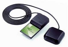
CF / GPS Reciver
Constructive module CF / GPS Reciver (such trade name) is designed as a CompactFlash card with a thickening at the top (where it is installed, all e-filling). Planar antenna is mounted on a hinge - stowed receiver takes the same space as the adapter "PC card - CF", that is quite a bit.Features priborchiki - Full compatibility with Pocket PC and Palm TRG-PRO. Simultaneous reception of signals from 12 satellites (12 channels). Maximum update rate (it is adjustable) up to 10 times per second. Dimensions, as I said, small, all the rest - the wisdom of specific techno ... Power consumed by the receiver, half a watt. The scale of the CCP, we should recognize just awesome. Not having sufficient experience in using GPS (on the part of wandering I am not Maclay), can hold only a rough parallel with the portable eTrex ... When I gave him second-hand and, accordingly, ponazhimat button, I noticed that the update rate is directly affecting the lives of batteries (in the eTrex - a pair of standard AA dry cells). What will happen to the battery handheld GPS unit when working at the maximum refresh rate, it is easy to predict - will die in minutes. However, no one is forcing to keep the GPS receiver turned on permanently. And the maximum value of the upgrade is not always necessary. In the car, when feeding a small computer from the cigarette lighter socket - no problem, in the harsh field conditions - only if necessary. Rotating antenna seems certain goods, especially in areas of poor reception of satellite signals - under trees, among the city buildings. Oriented the antenna can always find the best position, although the simpler elementary povertet themselves "pickpocket" - small is gizmos. Something like this and come with eTrex, when the satellite signal "go" ... I do not know - good or bad - but the factory specifications on the modulus values ​​are set ACK receiver start: 8 seconds at the "hot" start, up to 48 seconds - when the "cold". This is the time during which the receiver finds the satellite signals and is included in operating mode. In my opinion, a portable receiver (I can not get rid of the baby eTrex - very much like) to run much faster. Sorry, no it under his hands to check. With regard to practical application, at first glance a product of ACK must be no worse than others. Made it soundly, durable, compatible with all than normal and nothing special is no different. Normal module GPS ('d say it's someone I ten years ago) ...

Who will actually be

That is the question ... I would even say - the question of questions. For all the appeal of the plug-in GPS is far from ideal client a Global Positioning System. On the first limitation we have already said - a small amount of energy batteries PDA. With the module connected to the owner will inevitably have to seek external power supply, most likely from an onboard vehicle network.
GPS: a walk in the third millennium
The second limitation is typical for all PDAs. Inserting a free CF slot module GPS, we are deprived of access to that slot. That is, memory modules, wireless adapter Bluetooth, camera and everything else will have to leave in your pocket. And many handheld machines with memory napryazhenka - where to store the topographic map, if memory barely enough for basic job application? Next come the limitations GPS itself. In America and in Europe satellite navigation receiver will be a real helper, since it maps to the public (which exist in paper and electronic form) applied every forest tree stump, and every city street. As for us in Russia more or less distributed maps of Moscow and St. Petersburg, there are maps of suburbs and not just the Russian hinterland. That is to get pleasure from observing his movements directly on the color map, displayed a handheld computer, it will not always. Finally, the use of GPS receivers on the Russian territory subject to certain legal nuances. The device must be registered in Gossvyaznadzor and get the proper permission to use it. Why this fuss - is clear. The state is afraid of spies, although the spies are unlikely to buy GPS equipment in Russian stores.From this situation - the watchful guard arrested carefree tourist, beat him, "demokratizatorom" on the head, and selects the receiver. It is in the best case. At its worst - an article for espionage. Incidentally, many owners of GPS receivers that prospect does not frighten. I would, for example, even the thought of voluntarily go to Gossvyaznadzor to spend a day in the dusty corridors, there would be (well, that I still have not bought a GPS) ... This disadvantages. And the pros? They are much larger. With the GPS unit or a portable receiver you will not get lost in the stone jungle of Moscow, St. Petersburg and even thousands of thousands of foreign cities, towns, villages and hamlets. In the presence of Pocket PC you can safely consider its position with respect to streets and houses, reading the screen name of the first and numbers second. Zaplutat with such a powerful hint will only a complete idiot. In fungal and fishing wanderings GPS receiver easier terrain orientation, and routing. Even without a map you'll never lose orientation (only in dense fog, which turns out to be confusing and GPS, screening of satellite signals). In addition to the above, you will always be something to do on the walk - Have you eTrex, ACK or similar chepuhovinu. It's so funny - to calculate their geographic coordinates of the three broken civilization pines ...

A few words is not the topic

I do not know how someone while I was not tempted by the GPS receiver. But found in the prospectus of the company ACT Tech Corp. such a thing - in FM tuner for the slot CompactFlash Type I. Card on her two tiddly buttons - channel scanning and the power switch. For audio output using a sound system handheld computer. Operating Range - 78-108 MHz. Toy? Toy. But what is attractive. Since then I have about the fun begin dreaming. Why on this? It is hard to say ... Say, planned to strike at the heart of my friend's computer-based. Or just - it wanted. The authors, translation:

Pocket Navigator PN-4000 Advanced

The market for GPS navigation is rapidly gaining momentum. And if until recently it was only a few companies able to produce such devices, but now the situation has changed radically. On the shelves there are more browsers as world famous brands, as well as lesser known, but adapted to the realities of the domestic market. One such device is a Pocket Navigator PN-4000 Advanced from the new product line of Pocket Navigator MakTsentr. This is a relatively new trend, because previously most navigation devices under the brand name Pocket Navigator were produced on the basis of conventional PDA, if necessary, additional manning the GPS-receivers and the necessary software. The new line is, the main place is occupied by a device designed specifically for car navigation. So, we proceed to review.

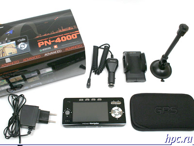
Box appearance, a complete set.

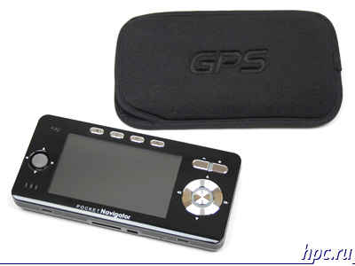
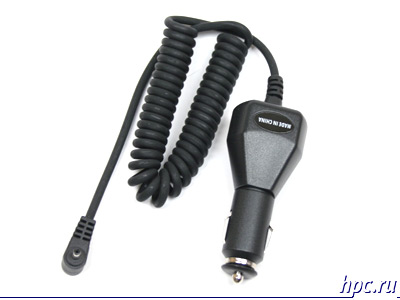
Opening the box of impressive size, we find inside the standard for such devices set: navigator, two chargers (car and Networking), the holder of a car and a neoprene case.
Pocket Navigator PN-4000 Advanced
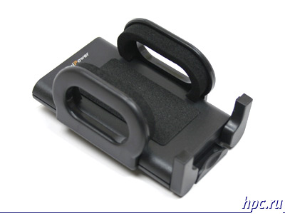
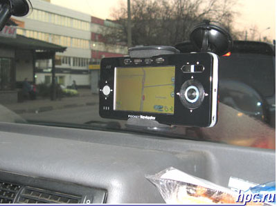
Let us dwell on the holder. It has a structure typical of most universal mount. Yes, it is universal. This solution entails both positive aspects and negative. On the one hand, it can be used not only for the navigator, as such, it is for the phone. After navigator need not every day, but the phone constantly. On the other hand, the flexible design is not strong enough for the device weighs 280 grams. When driving on rough roads PN-4000 starts to wobble, in this case, visually track the given route becomes difficult. However, serious shortcomings are currently not applicable in the process of driving almost do not have to stare at the map on the screen, in most cases, voice prompts.
Pocket Navigator PN-4000 Advanced
The remaining components supplied does not differ outstanding, everything is standard.
Pocket Navigator PN-4000 Advanced
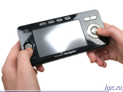
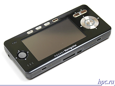
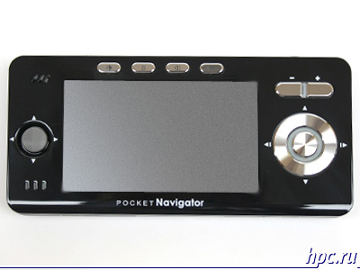
We proceed to design. Most of the front panel, as in most such devices is the touch screen. Its resolution is 480x272 points, and the diagonal is equal to 4. To his left is 4-way joystick, and performed it in a rather unusual style, and looks more like a speaker than the control. The right of the screen is the Five-way key. The presence of two controls at first seems strange, especially considering the fact that in most cases they overlap. Everything falls into place when you start the navigation program AUTOSPUTNIK in which buttons perform different actions.Joystick is responsible for the displacement maps and navigation button switches the day / night, includes quick search facilities and scheduling of routes, and changes the display mode maps with normal viewing mode to the motion.
Pocket Navigator PN-4000 Advanced
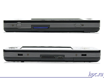
Above the display are four buttons: "Exit", "brightness", "volume", "settings". To the right, over the five-way button are swing «Zoom», with which you can zoom the map, or adjust brightness and volume. On the top of the device are two buttons: «power» and «hold». The bottom is fitted with two connectors - Mini USB and system, the latter is used to connect a UPI-module attachment to download information about traffic jams.
Pocket Navigator PN-4000 Advanced
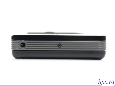
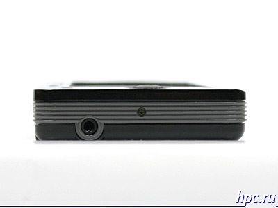
On the right side of the device is a connector for the charger, on the left - 3,5 mm headphone jack.
Pocket Navigator PN-4000 Advanced

Interface

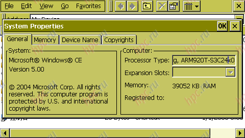
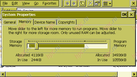
PN4000 is based on Samsung S3C2440 processor clocked at 400MHz. Built-in memory is divided into two areas: flash memory (128MB) and ROM / RAM memory (64MB), the latter is regulated, familiar to users of Windows Mobile 2003, the slider. With it you can increase or decrease the amount of RAM from ROM. Also in the unit supports cards format SD. The operating system uses open Windows CE 5.0. That is, it entails downloading third party applications.
Pocket Navigator PN-4000 Advanced
Simple graphical frontend. The main menu is four items: "Programs", "player", "Game / Photo", "Settings".
Pocket Navigator PN-4000 Advanced
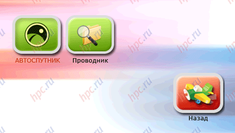
The first contains three items: "AVTOSPUTNIK - navigation program," Explorer "- a file manager and Games: Sudoku and Chess.
Pocket Navigator PN-4000 Advanced
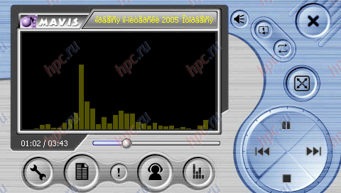
In the "Player" is a multimedia player.
Pocket Navigator PN-4000 Advanced
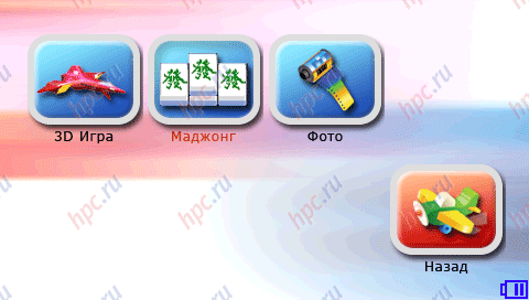
In the menu "Games / Photo" are two simple games and software for viewing images.
Pocket Navigator PN-4000 Advanced
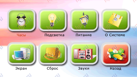
In "settings" you can: set time, change the brightness, see the exact battery and system information, to calibrate the display and set a background image, change the volume of system sounds and multimedia, as well as do a full reset the device.
Pocket Navigator PN-4000 Advanced
We should also note that all menus are traced in such a way that the control with your fingers does not cause any problems.

Navigation

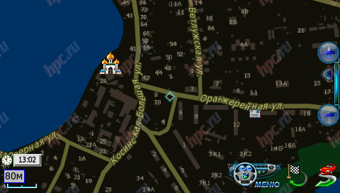
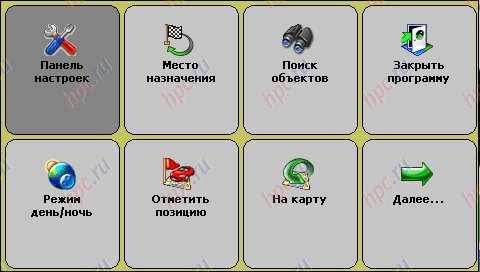
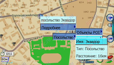
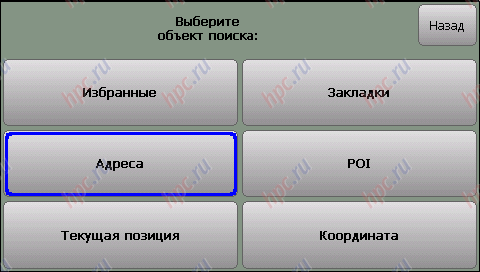
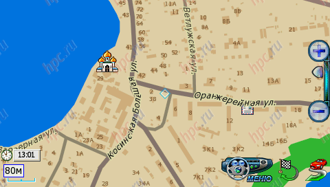
At the heart of the navigation component is PN4000, which became the standard for such devices, GPS-chipset SiRFstarIII. Virtually all navigators, equipped with this module, have similar characteristics starts. Our subject is almost not stand out: "Cold" - 2 minutes 31 seconds, "hot start - 3-5 seconds. However, it is worth noting that from time to time - 1-2 times a week, the device starts much slower than the above figures. The longest lift-off lasted 24 minutes 16 seconds. Explanation of this "meditation" we did not find. But the problem is solved elementarily - on the rear surface of the device is a button reset. After rebooting the machine starts to work in standard mode. Reception quality, as with all SiRFstar III navigators, beyond praise. The only place where reception from satellites is not possible, are the tunnels and underground parking. As a navigation application using the Russian program "AVTOSPUTNIK", which is a logical continuation of the project PocketGPS. She was already familiar to us from devices such as Glofiish X500/700. The program is completely Russified, and all the menus, settings and search adapted for use without a stylus, that is the size of icons correspond to the finger pad.
Pocket Navigator PN-4000 Advanced
Autosputnik: Day mode
Pocket Navigator PN-4000 Advanced
Autosputnik: Night mode
Pocket Navigator PN-4000 Advanced
Autosputnik: main menu
Pocket Navigator PN-4000 Advanced
Autosputnik: context menu
Pocket Navigator PN-4000 Advanced
Autosputnik: Object Search
Pocket Navigator PN-4000 Advanced
Autosputnik: Keyboard
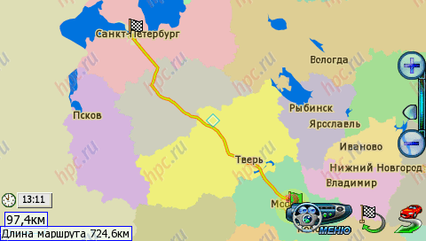
As a cartographic base maps used by the European TeleAtlas. At this stage, one of the best suppliers of cards, whose services are used by leaders of the navigation software like TomTom or iGO. However, there have TeleAtlas and cons, pay renewal cards, and insufficiently detailed coverage regions. That is, if you want to update the map on a date, you will have to pay for this procedure. "AVTOSPUTNIK" has two modes of map display - normal (top) and "pseudo» 3D. If you are using the latest image on the screen as appropriate to the type of the steering wheel. 2D view is useful when using the program as a regular card. And 3D is simply indispensable when driving a car. Speed ​​drawing cards mean, does not cause discomfort. Recalculate the route if you deviate from the set previously performed for 3-10 seconds, depending on complexity.
Pocket Navigator PN-4000 Advanced
In addition to standard features, typical for any navigation software, such as: construction of a route from one point to another, voice prompts, finding objects of interest (POI), the preservation of coordinates, "AVTOSPUTNIK" allows you to upload information about traffic jams and take it into account when a route. As a provider of traffic information used by news agency SMIlink. It is also worth noting that in the forums of the program - www.autosputnik.com there is a section in which users of the program indicate inaccuracies in the maps, in consequence, they are checked and accounted for in the preparation of updates. This enabled users can not boast of every navigation program. PN4000 supports upgrading the navigation software. To do this you must download the latest version on the SD card and insert into the device.

Multimedia features

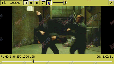
Additional features include a separate paragraph PN4000 selected player.This program is designed for viewing and listening to various multimedia files. To test videos were taken five standard rolls of different resolution and bitrate. Reproduced, only two - 320h176 256 kbit / s and 320x240 512Kbit/sek, two (640h352 1024Kbit/sek 1500Kbit/sek and 640x480) player is marked with a red and refused to lose. Same video, which has characteristics 160h216 192 kbit / s, and did caused the closure of the program with an error. This stems from the apparently exotic resolution video.
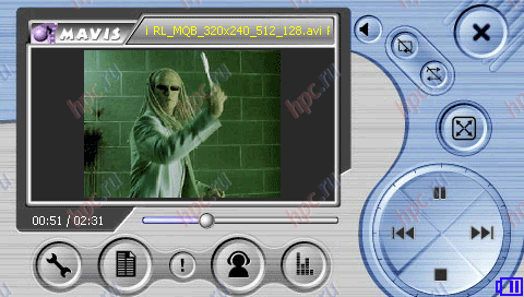
Pocket Navigator PN-4000 Advanced
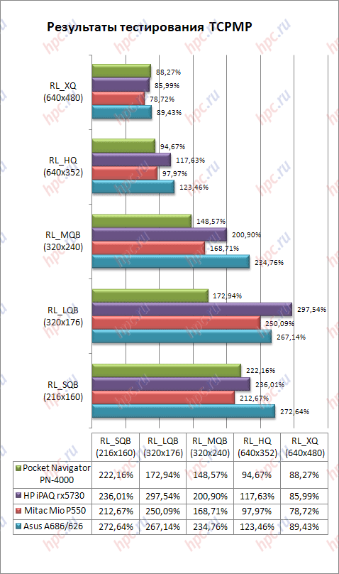
As a result of the test can be said that the player is very picky about the resolution and bitrate. It is therefore logical to view the video clips to use pre-prepared with low resolution and bit rate, or choose the player. For example, the same TCPMP without any problem installed on the PN-4000 and allows you to use all the features. By the way TCPMP coped with playing all the commercials, and naturally we had measured the playback speed of rollers, the results can be found in the table.
Pocket Navigator PN-4000 Advanced
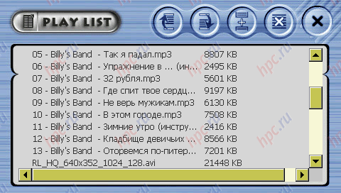
As seen from the comparison, the video capabilities PN-4000 are at a fairly high level. Navigator does not yield the usual PDA with similar characteristics. With your music player handles well, here gripes with no built-in player. The only negative aspect is not very easy system to work with playlists. However, after studying the manual, this problem disappears.
Pocket Navigator PN-4000 Advanced
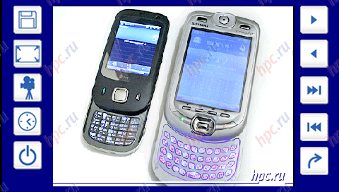
Also among the more applications we find a program for viewing images. It has a fairly modest set of features, among them - the output image on the screen and a slide show. The latter can even set the time of viewing each image. At this function the program for viewing end.
Pocket Navigator PN-4000 Advanced
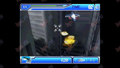
In addition to multimedia programs, PN4000 has multiple games that can entertain the user while parked, list them: «3D Game" - a simple "letalka" with the enigmatic running, and the main mission to "kill all".
Pocket Navigator PN-4000 Advanced
"Mahjong" - logic card game in which we were particularly touched by the presence of a "possible" games over the Internet.
Pocket Navigator PN-4000 Advanced
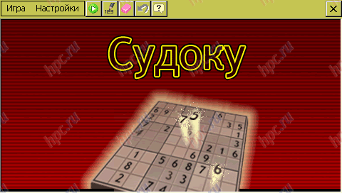
Sudoku - another puzzle with simple and intuitive control. The only disadvantage is the lack of any reference or rules of the game.However, nothing complicated about the game is not for a couple of minutes you can understand yourself.
Pocket Navigator PN-4000 Advanced
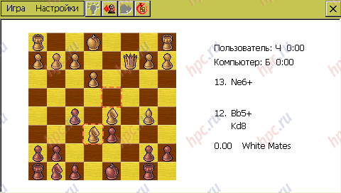
Well, the last game - Chess with the ability to set the difficulty of the game.
Pocket Navigator PN-4000 Advanced
As we have said, among installed programs, you can install other compatible operating system. For example, the famous explorer works fine reader Haali Reader. With his help, turned out to be very comfortable while away the time in traffic jams. A huge screen and set the settings of the text allow us to make this process comfortable even while driving.
Pocket Navigator PN-4000 Advanced

Hours

With daily use for 2-3 hours (the road to work and back) PN4000 worked for 3 days, while we used the maximum backlight and speaker volume. While viewing a video, under the same conditions the volume and backlight unit lasted 3 hours 40 minutes. These results are not surprising, given the capacity of the built-in Li-ion battery, it is 2000 mAh. In a more benign settings navigator can work out in 1,5 - 2 times longer.

Impressions

The unit left a very mixed impression. On the one hand, we see in front of a modern multi-function device is not the most successful implementation of the multimedia part. On the other hand PN4000, first of all, GPS navigator. Moreover, the main functional component is implemented with high quality and thoughtfully. However, given free access to operating system resources, multimedia components can be upgraded with the help of third party software. Moreover, we can not only improve the multimedia capabilities, but also add new, such as in our case to establish reading room. In the end, in front of us is a serious device with superior performance, rather high levels of ergonomics and the possibility of further upgrading through third-party programs.
Pocket Navigator PN-4000 Advanced
The authors, translation: